
Select NOAA-NWS Forecast Office Text Products
(Product availability varies with seasons, forecast office, and weather.)
Hazardous Weather Outlook for Twin Cities/Chanhassen, MN
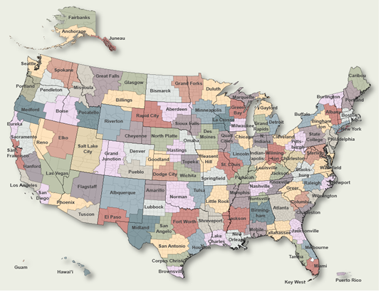
To Select Another NWS Office Click on Map or Choose from List
|
| Select Forecast Office: | Select Product: |
263 FLUS43 KMPX 012005 HWOMPX Hazardous Weather Outlook National Weather Service Twin Cities/Chanhassen MN 305 PM CDT Wed Apr 1 2026 MNZ053-060>063-065>070-073>078-082>085-091>093-WIZ014>016-023>028- 022015- Chisago-Hennepin-Anoka-Ramsey-Washington-Renville-McLeod-Sibley- Carver-Scott-Dakota-Redwood-Brown-Nicollet-Le Sueur-Rice-Goodhue- Watonwan-Blue Earth-Waseca-Steele-Martin-Faribault-Freeborn-Polk- Barron-Rusk-St. Croix-Pierce-Dunn-Pepin-Chippewa-Eau Claire- 305 PM CDT Wed Apr 1 2026 This Hazardous Weather Outlook is for portions of central Minnesota...east central Minnesota...south central Minnesota... southeast Minnesota...southwest Minnesota...northwest Wisconsin and west central Wisconsin. .DAY ONE...Tonight. A wintry mix of snow, sleet, rain, and freezing rain develops tonight. Ice accumulations up to a quarter of an inch along with snow & sleet accumulations of an inch or two. Highest ice accumulations expected in western Wisconsin due to freezing rain. .DAYS TWO THROUGH SEVEN...Thursday through Tuesday. The wintry mix comes to an end Thursday morning. Another round of accumulating snow is likely Saturday across central Minnesota & western Wisconsin. .SPOTTER INFORMATION STATEMENT... SKYWARN spotter activation will not be needed. $$ MNZ041>045-047>052-054>059-064-022015- Douglas-Todd-Morrison-Mille Lacs-Kanabec-Stevens-Pope-Stearns- Benton-Sherburne-Isanti-Lac Qui Parle-Swift-Chippewa-Kandiyohi- Meeker-Wright-Yellow Medicine- 305 PM CDT Wed Apr 1 2026 This Hazardous Weather Outlook is for portions of central Minnesota...east central Minnesota and west central Minnesota. .DAY ONE...Tonight. A wintry mix of snow, sleet, rain, and freezing rain develops tonight. Ice accumulations up to a quarter of an inch along with snow & sleet accumulations of an inch or two are likely. .DAYS TWO THROUGH SEVEN...Thursday through Tuesday. The wintry mix comes to an end Thursday morning. Another round of accumulating snow is likely Saturday across central Minnesota & western Wisconsin. .SPOTTER INFORMATION STATEMENT... SKYWARN spotter activation will not be needed. $$ |
Previous Hazardous Weather Outlooks may be found at
NWS Twin Cities/Chanhassen, MN (MPX) Office Hazardous Weather Outlooks.
(Click 'Previous Version' there to view past versions successively.
Some may differ only in time posted.)
Products Courtesy of NOAA-NWS
NWS Information Parsing Script by Ken True at Saratoga Weather - WFO and Products Scripts by SE Lincoln Weather.
Mapping by Curly at Michiana Weather and by Tom at My Mishawaka Weather.